
In early January 2019, the New Hampshire Department of Environmental Services launched a crowdsourcing effort to map all of New Hampshire's stone walls using LiDAR* images. Learn how to use the New Hampshire Stone Wall Mapper to identify and mark stone walls with nothing more than a web browser.
According to DES state geologist Rich Chormann, as quoted to Atlas Obscura, the "primary motivations for the project were to raise awareness of the state's stone wall legacy and inspire greater appreciation for them, which hopefully will lead to greater preservation, and to promote use and understanding of the state's LIDAR data."
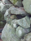
NHPR quoted Chorman, "You know, there’s no guarantee that these walls are going to exist in the future and so I think it’s important to record their existence, as best we can, today," said Chormann. "They’re emblematic of our landscape of the identity of the state of New Hampshire. And I think we would lose a part of who were are if we let them just be erased. "
*Light Detection and Ranging (LiDAR) is a remote sensing technology that assists archeologists in locating and identifying cultural features and landforms that are typically undetectable by traditional aerial photography, such as beneath heavy tree canopies. LiDAR utilizes light in the form of a pulsed laser to measure ranges, or distances to the ground surface. Variations in the return of laser reflections are processed to generate a digital elevation model. While LiDAR images may resemble strange and exotic landscapes, to the trained eye they reveal man-made features of the landscape, including cellar holes, stonewalls, and relict roadways.